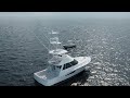
GPSMAP® 8610 Multifunction Display with US and Canada Navionics+ Charts


Complete Your Purchase


The GPSMAP® 8610 chartplotter features a 10” full HD in-plane switching touchscreen display for wider viewing angles, superior clarity and sunlight readability, even with polarized sunglasses. Experience superior connectivity and networking solutions with complete control of your entire system, right at your fingertips.
The device is preloaded with Garmin Navionics+™ coastal charts and inland mapping that feature Auto Guidance+™ technology (Auto Guidance+ is for planning purposes only and does not replace safe navigation operations) for helping you get where you need to go. Plus, there’s support for optional Garmin Navionics Vision+™ premium map content. GPSMAP 8610 includes a premium-performance processor for our fastest map drawing, superior networking, video distribution and more. Multiple displays can be flat mounted edge-to-edge to create a sleek glass helm look or mounted flush. NMEA 2000® networking and the Garmin Marine Network allow you to build your full marine electronics suite — from radar and autopilots to cameras and instruments — controlled from your chartplotter and shared across multiple screens. With SmartMode™ station controls, everything is designed to give you quick, one-touch access to the information you need to ease high-stress situations such as docking. For full control of your boat on your chartplotter screen, use our exclusive OneHelm™ feature to connect to many compatible third-party devices. Built-in Garmin SailAssist™ features provide data, displays and prerace guidance to help you gain a competitive edge. Download the ActiveCaptain® smartphone app to your compatible smartphone or tablet to manage your marine experience — from trip planning and prefishing to purchasing, downloading and updating maps. See RPMs, fuel flow, temperature, trim and more for up to four of your compatible Mercury® engines by using the SmartCraft® Connect gateway.
Key Features
- Features a 10” full HD in-plane switching touchscreen display for wider viewing angles, superior clarity and sunlight readability, even with polarized sunglasses
- Adds a stunning appearance with ability to install multiple displays either flat mounted edge- to-edge to create a sleek glass helm look or mounted flush
- Fully network capable with NMEA 2000® connectivity and the Garmin Marine Network to easily build your marine system — from sonar, radar and autopilots to instruments, cameras and multimedia
- ANT® connectivity and Wi-Fi® networking let you connect with your compatible quatix® smartwatches, gWind™ Wireless 2 wind sensor and more
- Preloaded Garmin Navionics+™ coastal charts and inland mapping feature Auto Guidance+™ technology (Auto Guidance+ is for planning purposes only and does not replace safe navigation operations); plus, there’s support for optional Garmin Navionics Vision+™ premium map content.

You May Also Like


